-
-
Add to cart
 Quick View
 - Americas, Canada and The Great Lakes, East & Midwest United States, United States
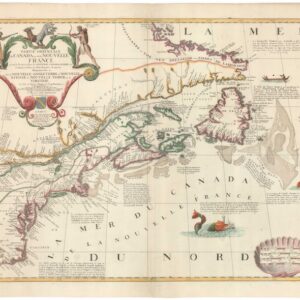
Partie Orientale du Canada ou de la Nouvelle France…
- 1689 Coronelli-Nolin Map of Eastern Canada and the Northeastern United States.
-
-
-
-
Add to cart
 Quick View
 - Curiosities - Miscellanea, World
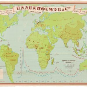
Daarnhouwer & Co — Established 1908 — Countries of Origin for the Major Spices.
- $375
- 1971 Thematic World Map of the Global Spice Trade.
-
-
-
-
Add to cart
 Quick View
 - San Francisco
U.S. Coast Survey A.D. Bache, Superintendent, City Of San Francisco And Its Vicinity California. From a Trigonometrical Survey by R.D. Cutts, Assistant… (Copy)
- $1,900
- Hand-colored 1853 United States Coast Survey master sheet map of the San Francisco Peninsula.
-
-
-
-
Add to cart
 Quick View
 - California, San Francisco
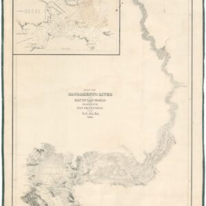
Map of Sacramento River and Bay of San Pablo with Harbour of San Francisco by the U.S. Ex. Ex. 1841.
- $4,500
- Extremely rare 1841/1858 Wilkes U.S. Exploring Expedition Map of the Sacramento River and San Francisco Harbor.
-
-
-
-
Add to cart
 Quick View
 - Europe, Italy
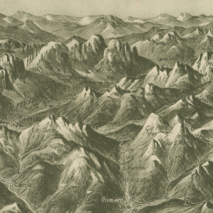
Panorama del Trentino.
- $325
- Circa 1930 J.F. Amonn Panoramic View of the Trentino-Alto Adige and the Dolomites.
-
-
-
-
Add to cart
 Quick View
 - Pictorial maps, San Francisco
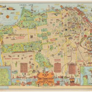
Map of San Francisco Showing Principal Streets and Places of Interest.
- $3,500
- Roaring Twenties Pictorial Map of San Francisco.
-
-
-
-
Add to cart
 Quick View
 - Africa
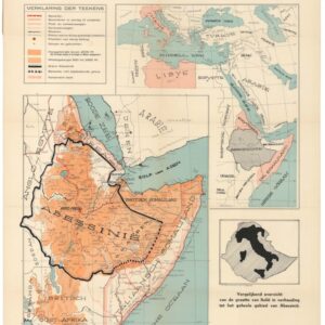
Oorlogskaart van Abessinië. Italiaansche Koloniën en Omiliggende Landen.
- $200
- Circa 1935 War Map of Abyssinia and the Italian Colonies at the Outbreak of the Second Italo-Ethiopian War.
-
-
-
-
Add to cart
 Quick View
 - California, Marin, Sonoma, & Napa Valley
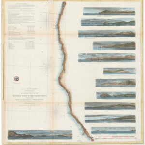
U.S. Coast Survey — Reconnaissance of the Western Coast of the United States, Middle Sheet, From San Francisco to Umpouah River.
- $425
- 1854 U.S. Coast Survey Reconnaissance from San Francisco to the Umpqua River.
-
-
-
-
Add to cart
 Quick View
 - Americas, Mexico - Central & South America
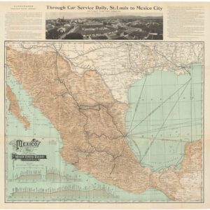
Mexico — Map of the Mexican Central Railway and Connections.
- $475
- 1908 Mexican Central Railway Map of Mexico.
-
-
-
-
Add to cart
 Quick View
 - East & Midwest United States, United States
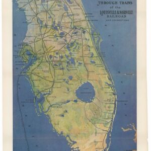
Florida: America’s Famous Winter Resort State, Reached by the Magnificent Through Trains of the Louisville & Nashville Railroad and Connections.
- $375
- 1915 Louisville & Nashville Railroad Map of Florida.
-
-
-
-
Add to cart
 Quick View
 - Africa
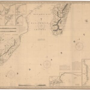
Chart of Southern Africa, and of the Islands of Madagascar, Bourbon and Mauritius.
- $1,400
- 1856 Imray Nautical Chart of Southern Africa and Madagascar.
-
-
-
-
Add to cart
![[Propaganda map] Deutsches Volkstum in aller Welt. Bearbeitet von Dr. Friedrich Lange.](https://neatlinemaps.com/wp-content/uploads/2026/03/NL-02488_thumbnail-300x300.jpg) Quick View
Quick View - World, World War I and World War II
[Propaganda map] Deutsches Volkstum in aller Welt. Bearbeitet von Dr. Friedrich Lange.
- $1,400
- Propaganda cartography from Europe’s darkest hour.
-
-
Shop
All maps in stock, sorted by latest.